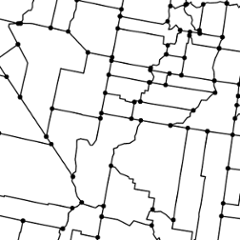
TopoJSON Server
The topojson-server module provides tools for converting GeoJSON to TopoJSON. See How to Infer Topology for details on how the topology is constructed.
See shapefile for converting ESRI shapefiles to GeoJSON, ndjson-cli for manipulating newline-delimited JSON streams, d3-geo-projection for manipulating GeoJSON, and topojson-client for manipulating TopoJSON and converting it back to GeoJSON. See also us-atlas and world-atlas for pre-built TopoJSON.
Installing
If you use NPM, npm install topojson-server. Otherwise, download the latest release. You can also load directly from unpkg. AMD, CommonJS, and vanilla environments are supported. In vanilla, a topojson global is exported:
<script src="https://unpkg.com/topojson-server@3"></script>
<script>

var topology = topojson.topology({foo: geojson});

</script>
Try topojson-server in your browser.
API Reference
# topojson.topology(objects[, quantization]) <>
Returns a TopoJSON topology for the specified GeoJSON objects. The returned topology makes a shallow copy of the input objects: the identifier, bounding box, properties and coordinates of input objects may be shared with the output topology.
If a quantization parameter is specified, the input geometry is quantized prior to computing the topology, the returned topology is quantized, and its arcs are delta-encoded. Quantization is recommended to improve the quality of the topology if the input geometry is messy (i.e., small floating point error means that adjacent boundaries do not have identical values); typical values are powers of ten, such as 1e4, 1e5 or 1e6. See also topojson.quantize to quantize a topology after it has been constructed, without altering the topological relationships.
Command-Line Reference
geo2topo
# geo2topo [options…] [name=]file… <>
Converts one or more GeoJSON objects to an output topology. For example, to convert a GeoJSON FeatureCollection in the input file us-states.json to a TopologyJSON topology in the output file us.json:
geo2topo states=us-states.json > us.json
The resulting topology has a “states” object which corresponds to the input geometry. For convenience, you can omit the object name and specify only the output file name; the object name will then be the basename of the file, with the directory and extension removed. For example, to convert the states.json GeoJSON FeatureCollection to a TopologyJSON topology with the “states” object in us.json:
geo2topo states.json > us.json
Any properties and identifiers of input feature objects are propagated to the output. If you want to transform or filter properties, try ndjson-cli as demonstrated in Command-Line Cartography.
See also topo2geo.
# geo2topo -h
# geo2topo --help
Output usage information.
# geo2topo -V
# geo2topo --version
Output the version number.
# geo2topo -n
# geo2topo --newline-delimited
Accept newline-delimited JSON, with one feature per line.
# geo2topo -o file
# geo2topo --out file
Specify the output TopoJSON file name. Defaults to “-” for stdout.
# geo2topo -q count
# geo2topo --quantization count
Specify a pre-quantization paramter. 0 disables quantization. See topojson.topology for a description of quantization.
